The following is an excerpt from Urban Land Institute, from an article published in September, 2025

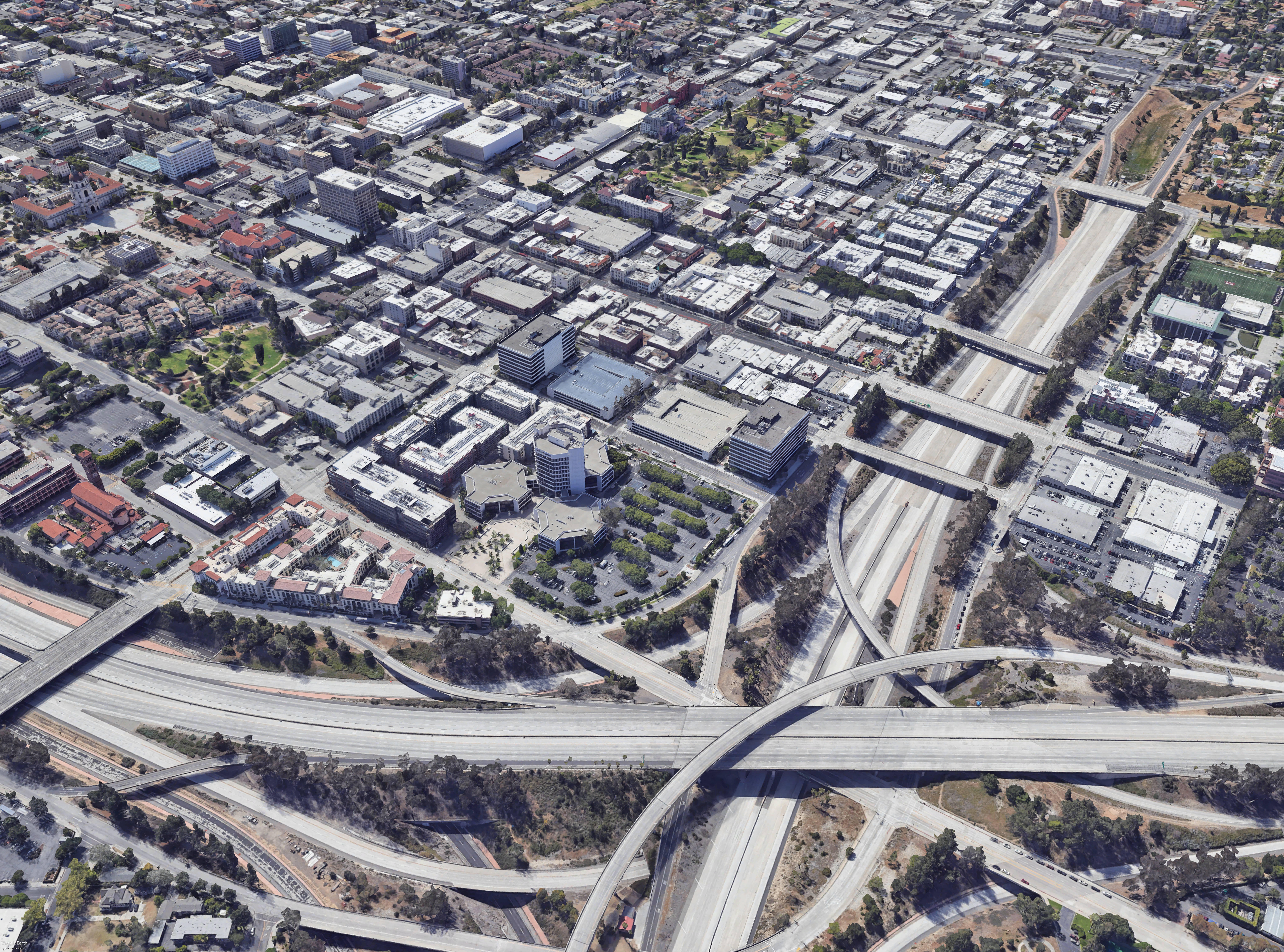
Intersection of SR 710 Stub (top to bottom) and 210 (left to right). © Perkins Eastman
The opportunity to plan and design more than 50 acres of inner-city urban development in any city is significant, but in Pasadena, California, it is a possible inflection point in the city’s history, an opportunity to redress past mistakes, and to set the stage for future generations to benefit from perceptive and forward-thinking planning.
In early 2024, Pasadena selected Perkins Eastman to develop a new master plan to transform the city’s historic downtown. The intent? Decoupling the stub end of the State Route 710 freeway from regional circulation and reconnecting this strip to the local street grid by adding new bikeways, greenways, paseos, and urban gardens to repair the city’s divided urban fabric, and to set the stage for a new era of development. This project represented a rare chance to reflect on the past, heal, and define a balanced path forward.
Similar past efforts with other communities informed Perkins Eastman’s approach to the Pasadena plan. In these planning endeavors, more can be gained than just filling in a gap; if thinking is broadened and difficult questions are posed from the outset, the whole can be greater than the sum of its parts. Fortified with this expertise, Perkins Eastman set out to listen, learn, and guide.
What began during the 1930s with the redlining of neighborhoods in the United States—activity that created historical and current patterns of racial and ethnic segregation in our cities—was followed by a second blow, the construction of freeways, which started in the 1950s and further divided many neighborhoods. Once maps were rolled out to identify routes for both Interstate 210 and SR 710 in Pasadena, the communities that had previously been redlined fared the worst, adding to a legacy of environmental and social inequality. Compounding this wrong, the January 2025 Eaton Fire, which had a devastating and disproportionate impact on nearby Altadena’s Black residents, heightened the need to heal and reconnect communities.
In its heyday, from the late 19th century through the 1920s, downtown Pasadena was a thriving mercantile and urban neighborhood. By the 1960s, however, plans for the 210 Foothill and SR 710 Long Beach freeways were introduced to connect Pasadena to major highways. These efforts led to the removal of developable land from the tax rolls and loss of affordable housing for minorities, the elderly, and low-income families, further contributing to the area’s decline.
In the 1970s and 1980s, an awakened respect for the city’s architectural treasures led to the renovation of historic homes and buildings throughout Pasadena.
Nowhere was the makeover more apparent than in Old Pasadena, where the city’s business district first began. Revitalization of this area occurred throughout the 1980s and culminated at the end of 1992 with the completion of the One Colorado historic block. Transformed into a dining, shopping, and entertainment district, Old Pasadena is now a major attraction in southern California. Yet the scar of the SR 710 remains.
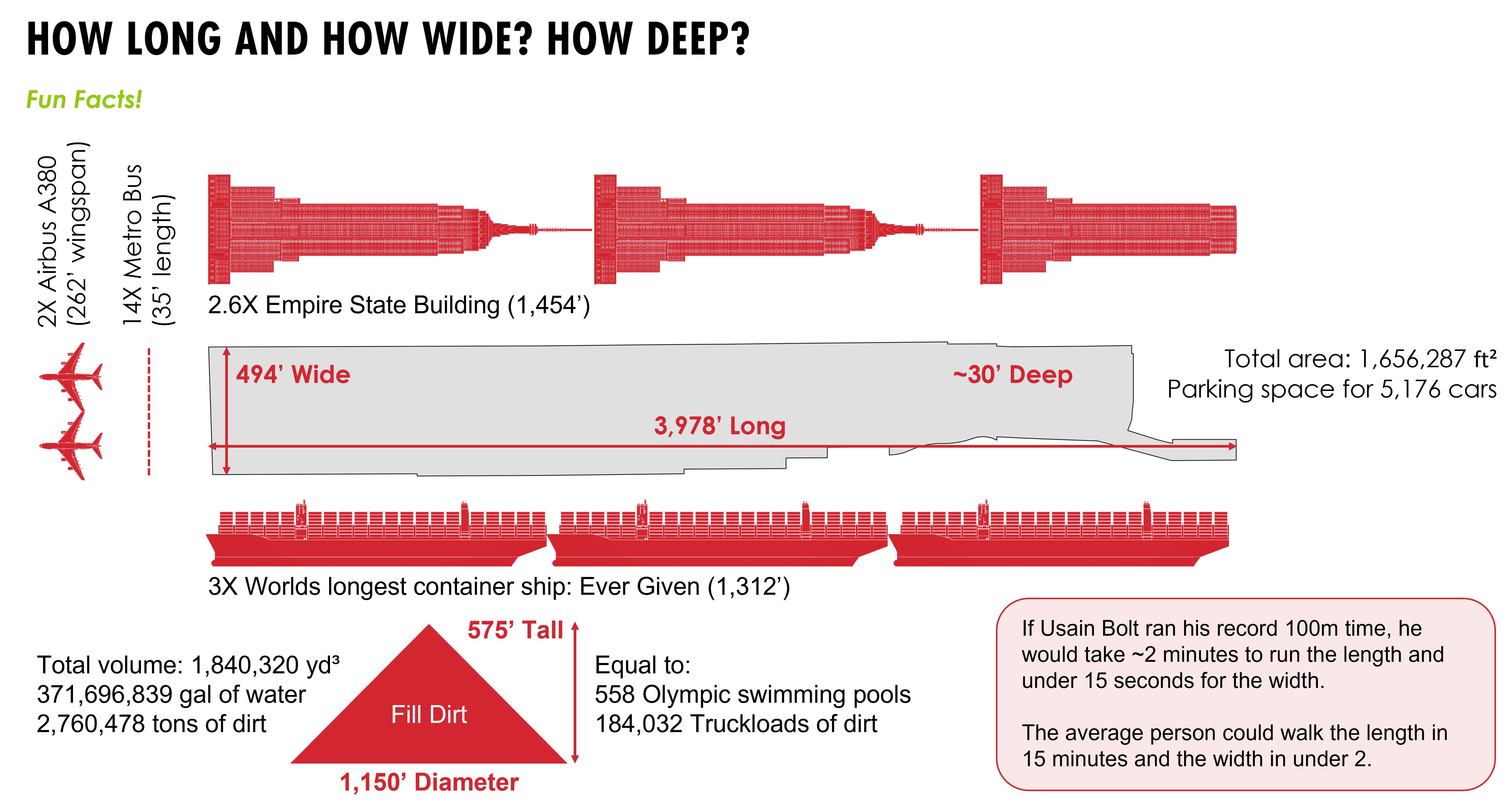
Today, with the relinquishment of the SR 710 Stub—as locals call the end of SR 710 where the road drops into a ditch more than two-and-a-half times longer than the Empire State Building is tall, and 30 feet deep—a new opportunity exists to redress the historical impacts of freeway development.

Graphic of scale comparisons to communicate the size of the Pasadena site. © Perkins Eastman
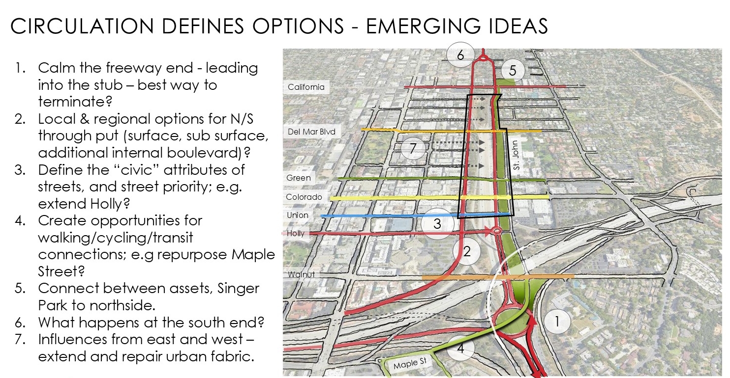
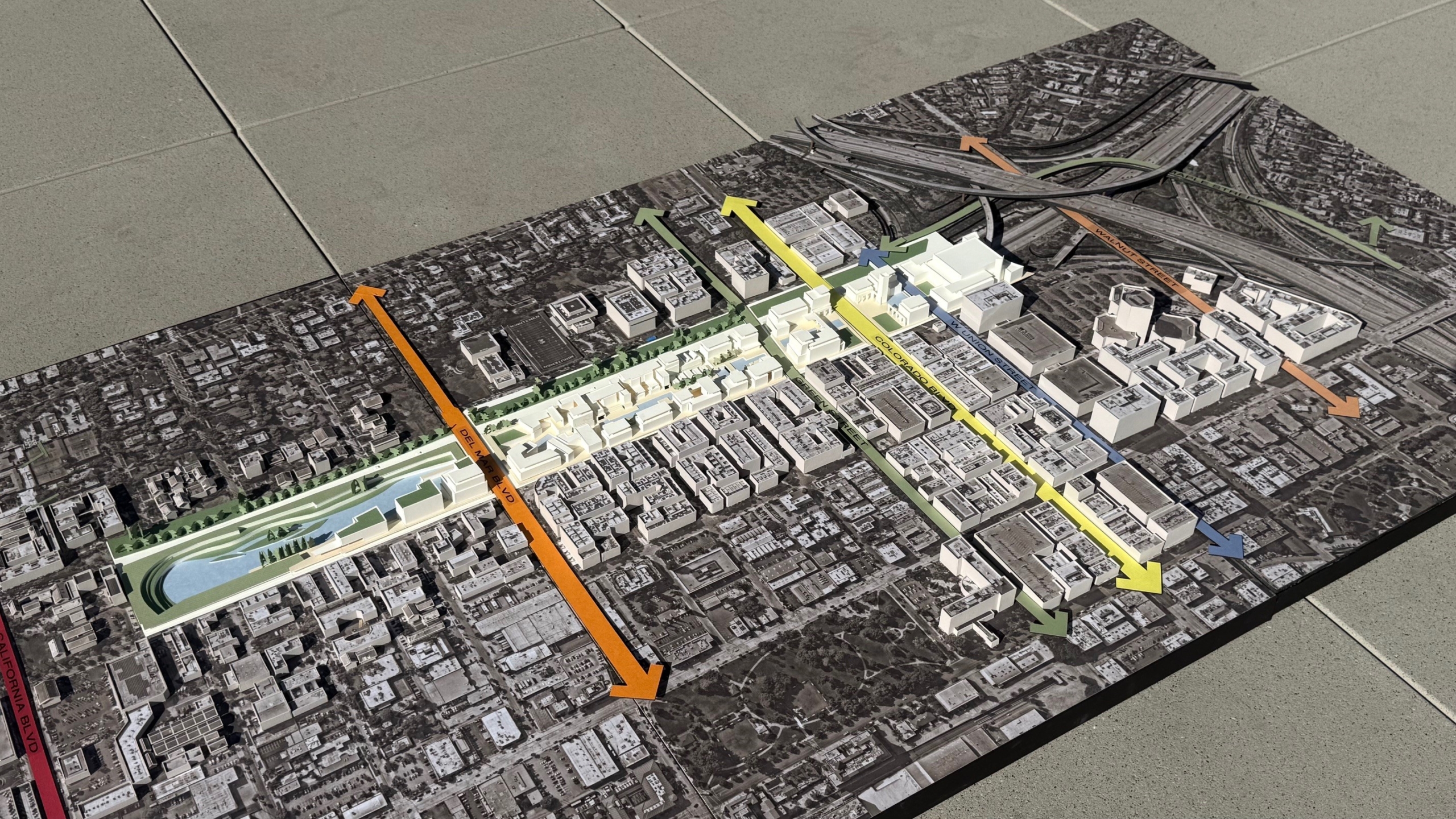
Of the plan’s many benefits, the SR 710 Stub presents the opportunity to terminate the freeway and create a more well-behaved pattern and scale of ways to restitch the urban fabric. Prioritizing the pedestrian experience in lieu of the automobile provides one example. By re-establishing a network of greenways, bikeways, paseos, and walkways, as well as repurposing former elevated freeway ramps, the plan fuses together the public realm, reconnects severed neighborhoods, and creates new opportunities for many special places to emerge.

Diagram outlining opportunities to restitch the urban fabric. © Perkins Eastman
