Insights

The Public Wins—and Development Follows—When Master Plans Start Small

Well-designed streets, stations, pathways, and parks lead the way to long-term investment and growth.
By Vaughan Davies, Principal, and
Kate Howe, Principal and Transportation + Infrastructure Practice Leader
Imagine East Bank Vision Plan Rendering
The Imagine East Bank Vision Plan shapes a mixed-use district that borders green space cascading down to the Cumberland River. Renderings © Perkins Eastman

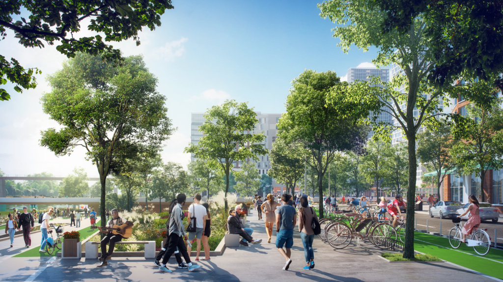
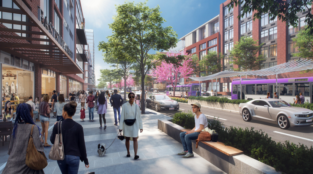
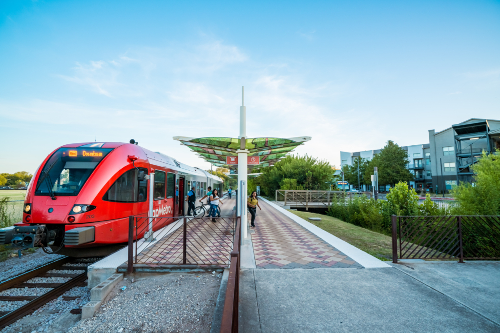
Cities looking for economic growth and a revitalized skyline should begin their development efforts at eye level. Public infrastructure is not only necessary for new development—it is the draw. Master plans that prioritize well-designed public space and multimodal transportation make mixed-use development viable. Yet building community consensus and momentum to deliver complex, large-scale projects with multiple stakeholders across the public and private sectors is challenging. That is why the initial phases should focus on public spaces and the connections between them. Municipalities can use existing infrastructure grants and funds to create value that will spur much larger investments over the life of the plan. Our teams are advising municipalities and transit agencies on phase-one strategies at different scales across the country.
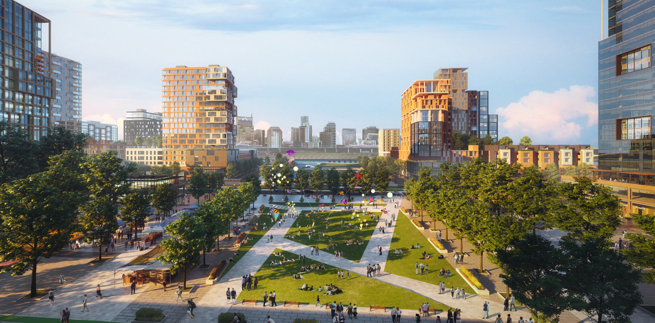
Activating a Thriving New District
Riverside Walkway, East Bank Nashville

The Imagine East Bank Vision Plan calls for a riverside drive, walkway, and parks along the water. The new green space will also serve as a filter, slowing floodwater before it flows into the river.

A major transformation is underway on the East Bank of Nashville’s Cumberland River. New infrastructure, mixed-use development, housing, parks, and improved mobility are taking shape across more than 300 acres, anchored in part by the construction of the new Tennessee Titans football stadium. The area is poised to become a connected, walkable riverfront district and a vibrant extension of downtown Nashville. The new home for the Tennessee Performing Arts Center will be located on a planned cultural terrace on the waterfront, which will act as a gateway for people crossing the historic John Seigenthaler Pedestrian Bridge. Perkins Eastman’s Imagine East Bank Vision Plan, adopted by the city’s Metro Council in 2022, is guiding the work. It identified the parcel where the arts center is being built, and it enabled the Titans to demolish its outdated facility and move further inland to become the focal point of a mixed-use riverfront neighborhood.

The Public Wins—and Development Follows—When Master Plans Start Small 1

East Bank Boulevard is planned with wide, pedestrian-friendly sidewalks, bike lanes, and landscaping.

Our vision plan won early funding for its signature element, a new transit-ready, multimodal East Bank Boulevard designed to unite a series of disconnected, underdeveloped parcels. This north-south corridor will include wide sidewalks, bike lanes, and bus rapid transit and serve as a crucial connector for local and regional traffic. “This would stitch together communities divided by water and interstate and provide continuity for commuters on the south end of the multimodal corridor,” according to a news report published after the Metro Council approved the plan.

Enabling Economic Development in California’s Central Valley
The Public Wins—and Development Follows—When Master Plans Start Small 2

A concept for a promenade, overlook, and mixed-use district along Yuba City’s Feather River would create waterfront views over 30-foot-high levees, street upgrades, and a new bike and pedestrian trail. © Perkins Eastman

The confluence of the Feather and Yuba Rivers makes for rich, fertile cropland surrounding Yuba City, an agricultural community north of Sacramento, but the waterways have historically rendered the area prone to punishing floods and contributed to slow development. Now the city is considering how their 200-year storm levees, built between 2010 and 2017, can be leveraged to unlock development potential and encourage local residents to explore cultural and entertainment destinations in Yuba City rather than in more amenity-rich cities nearby. We are helping the city craft strategies for the levee area and address other growth issues as it begins to update its zoning codes. The goal is 300-plus acres of development in districts throughout the city, which will take decades to realize. The first step involves the creation of trails and boulevards to guide growth.

The Public Wins—and Development Follows—When Master Plans Start Small 3

The vision for Yuba City’s future identifies districts for development, a bike and pedestrian trail that connects them, and upgraded streets between downtown and the riverfront.

Our vision outlines the transformation of an abandoned rail line into a trail linking into the Sutter Commuter Bikeway and connecting multiple urban sites targeted for residential, entertainment, sports, and commercial uses. The visioning also proposes a new Levee District with hospitality, restaurants, promenades, and overlooks, as well as upgrading local streets that lead from the city’s central Plumas Street down to the Feather River—all designed to link the city to its waterfront heritage.

Envisioning a New Transit Hub to Accelerate Growth
Crestview Station, Red Line, Austin, TX

A new transportation facility will be expanded from the Crestview Station’s existing single platform in North Austin. Photograph Courtesy Capital Metropolitan Transportation Authority

In Austin, we are designing the long-term vision for the Red Line’s Crestview Station, guiding its transformation into a multimodal civic hub that can anchor its fast-growing neighborhood. To realize this vision, we must first help our client, the Capital Metropolitan Transportation Authority, invest in smaller, near-term projects. This approach helps the agency coordinate with other government entities to plan larger, longer-term capital improvements. The goal is a fully grade-separated, double-tracked commuter-freight corridor with adjacent light rail service. First, we are carefully aggregating interventions over the next 15 years that will support the new corridor and light rail. They may include making room for the Red Line Bike Trail along the trackway and station, enhancing pedestrian safety in the vehicular intersection, and ensuring nearby redevelopment parcels are activated and responsive to the future transit-rich environment. These elements will help build the case for funding to start the larger transformation as early as possible.

Kickstarting Future Development

At every scale, master plans with a clear vision find added value in the infrastructure that spurs and anchors new development. Without these pragmatic first steps, municipalities may miss opportunities for progress toward larger goals. Advocating for smaller, visible projects—a central boulevard and abundant green space, trails and pedestrian-friendly streets that enable economic development, a reimagined commuter environment that helps a neighborhood grow—in the pipeline of a larger master plan enables our clients to leverage available earmarked funding to make their future large-scale plans shovel-ready now.

 
For media inquiries, please reach out to: news@perkinseastman.com.